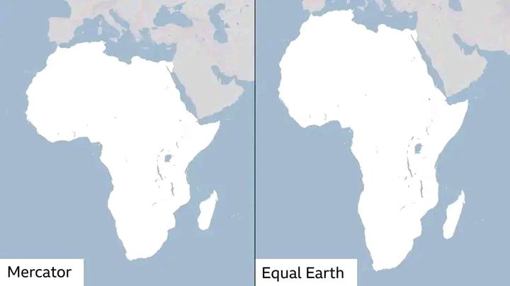
The UN General Assembly has voted overwhelmingly to encourage governments, schools and tech companies worldwide to stop using maps that make Africa look far smaller than it really is.
On Friday, September 4, 2026, the United Nations General Assembly passed a historic, African-led resolution to transition away from the traditional 16th-century Mercator projection.
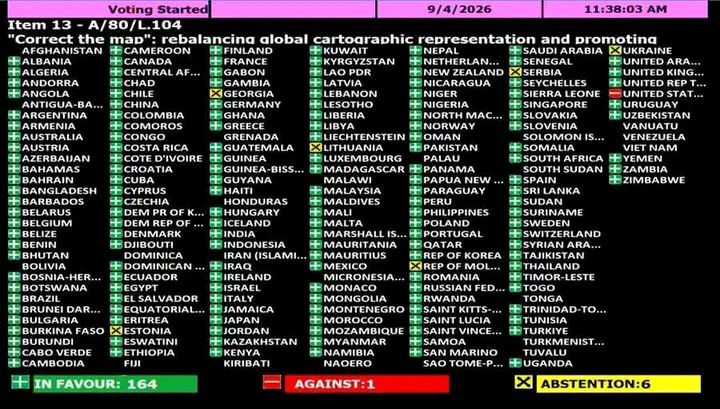
By 164 votes to one, Member States on Friday endorsed a resolution promoting map projections that more accurately reflect the true size of continents – the culmination of an African-led campaign against the 16th-century Mercator projection, still the most widely used map in the world.
Friday’s vote gave near unanimous international backing to an argument which many African governments have increasingly pressed: that the choices we make over maps can shape how generations understand the world.
The Vote Breakdown: 164 nations voted in favor, six countries abstained (Estonia, Georgia, Lithuania, Moldova, Serbia, and Ukraine), and the United States cast the sole opposing vote, dismissing it as an “ideological agenda.”
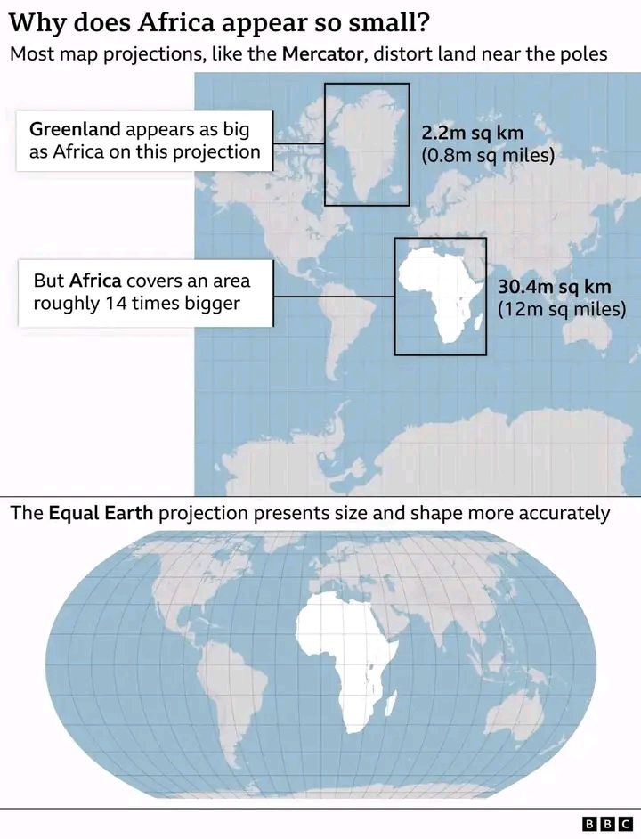
The Mercator Distortion: Created in 1569 by Gerardus Mercator, the traditional map significantly stretches landmasses near the poles while shrinking those near the equator. Consequently, Greenland and Africa appear roughly equal in size on a standard map, even though Africa is actually 14 times larger.