Francistown Used to Be Zimbabwe, Victoria Falls on Zambia side, Its All Zimbabwe’s Land
How conmen drew Zim borders, We Kept 4 Islands, Zambia Got 7
By Fanuel Viriri
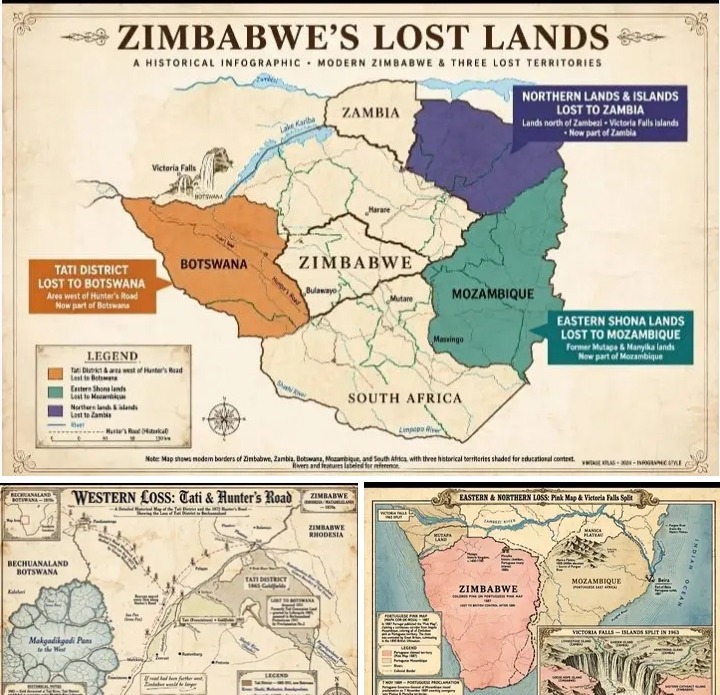
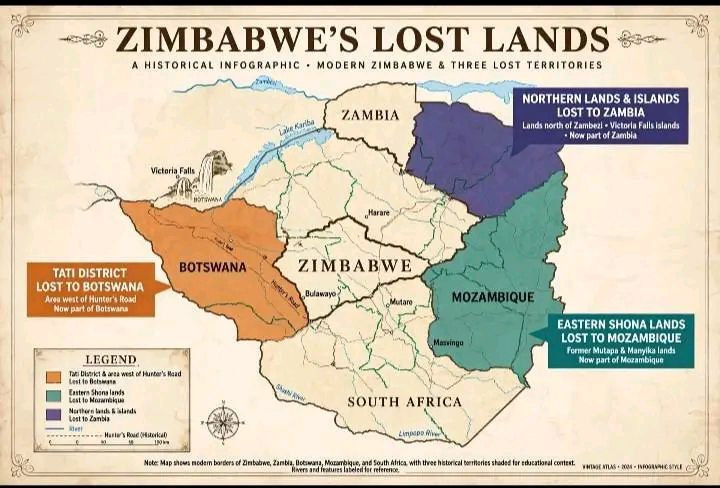
Zimbabwe lost Francistown, vast hunting grounds and even islands at Victoria Falls because its borders were created by con-men, a historian has revealed.
In his 2017 paper “Lines and Lies: The Evolution of Zimbabwe’s National Border”, historian Paul Hubbard says modern Zimbabwe is compact because European concession hunters and colonial officers drew lines that served themselves.
“Francistown was ours. It was called Tati,” Hubbard writes.
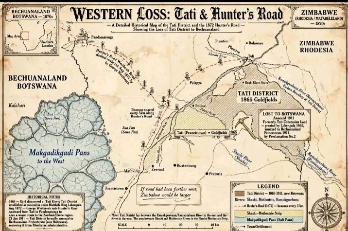
It was the country’s first goldfield. Hunter Henry Hartley discovered gold on the Tati River in 1865. Mzilikazi claimed the area by proclamation in 1867. When Lobengula became king, he made trader John Lee governor of Tati.
Lobengula had a strategy. He granted concessions over the same land to different Europeans to make them pay tribute. That would prove he owned it.
He gave Tati to C.C. Levert in 1870, then to Dan Francis and Sam Edwards. Their company became the Tati Concessions Mining and Exploration Company, backed by mining magnate Alfred Beit.
The trick backfired
On 1 November 1893, as Ndebele forces were collapsing, Tati manager Frank Kirby hoisted his own flag and declared all land between the Shashi and Ramaquabane rivers to be British territory – but not part of Rhodesia.
Britain agreed. The 1894 and 1898 Orders-in-Council that defined Rhodesia specifically said “excluding the area known as the Tati district”.
High Commissioner Sir Henry Loch had already handed the area to the Bechuanaland Protectorate in late 1892. In 1911 it was formally annexed. Tati became Francistown. It is now north-east Botswana.
Next to it went the Shashi-Motloutse Strip, between the Shashi and Motloutse rivers. It was covered by the Wood, Chapman and Francis Concession of 1887. Both Lobengula’s hunters and Khama III’s Ngwato people used it. Both chiefs claimed it. It also went to Botswana.
The western border was an even bigger loss.
Cecil Rhodes claimed on the basis of the Rudd Concession of 30 October 1888 that Lobengula’s country stretched to the Makgadikgadi Pans. London rejected the claim.
Instead, the border became a wagon track.
George Westbeech cut what became known as Hunter’s Road or Westbeech Road in August 1872. It was a 200km track from Tati to Pandamatenga, marked by pans and waterholes to avoid the tsetse fly belt. Beacons were placed every 3km.
When a joint commission fixed the border in 1907 after years of truce, it simply adopted the road. Hubbard notes: if the road had been cut further west, Zimbabwe would be that much larger.
To the south, the Limpopo held.
In 1891 about 1,000 Boer trekkers led by Col. Ignatius Ferreira trekked north and declared the Republic of Banyailand, covering Masvingo. On 24 June 1891 they reached the Limpopo. The British South Africa Company had fortified the drifts. Dr Leander Jameson told them no Boer concession would be recognised. Most turned back.
To the east, Portugal nearly took the whole country.
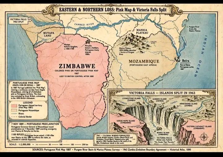
Its 1887 Pink Map coloured all of Zimbabwe pink as part of a corridor from Angola to Mozambique. In winter 1889, Joaquim Paiva de Andrada marched onto the Manica Plateau with 1,100 rifles. Chiefs from Gutu, Makonde, Nyandoro, Seke, Mutoko and Marandellas took the Portuguese flag. On 7 November 1889 Portugal proclaimed ownership to the Umfuli and Sanyati rivers.
British Prime Minister Lord Salisbury rejected the Pink Map. The Anglo-Portuguese treaties of 1891 and 1899 saved Manicaland, but Shona lands east of the current line remained Mozambique.
To the north, the Zambezi was lost.
The 1898 Order-in-Council fixed the northern border along the middle of the Zambezi from the Chobe to Mozambique. All land north became Northern Rhodesia, now Zambia.
The final cut came at Victoria Falls itself.
On 20 December 1963, eleven days before the Federation of Rhodesia and Nyasaland ended, Britain issued a new Order-in-Council splitting the Falls islands and Lake Kariba by latitude and longitude along the drowned river channel.
Zambia was given Livingstone Island and five others: Princess Helena Victoria, Princess Margaret, King George VI, Princess Elizabeth, Canary and Palm.
Zimbabwe kept only four: Princess Victoria, Princess Christian, Marie Louise and Kandahar. #history




Noise maker!
Get on with life, victoria falls is on the Zambian side. The better view may be from the Zimbabwean side that we agree.